
GIS and Mapping
Geographic Information Systems or G.I.S. is mapped data of county roads, addresses, tax parcels and municipal boundaries. GIS can show many different kinds of data on one map allowing analysis of patterns and relationships. More importantly, GIS Data can be purchased for public use.
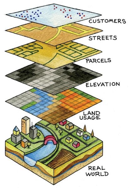
Geographic Information Systems (GIS) are utilized to create, maintain, and display digital data or information related to geographic positions on the Earth’s surface. One of the many benefits of using GIS software to display data is the ability to display graphical information about the earth’s surface in layers as if the data were stacked on top of one another. For instance, a layer displaying local roads is a prime example of a layer that would be displayed over the base map of a geographic location. Base maps are usually aerial imagery or topological relief maps. So, when you imagine displaying the local road information as a “layer” of lines on top of the aerial imagery of Wyoming County, you can begin to understand the concept of a GIS for many purposes.
GIS Data Sets for Sale
Please fill out the form found below and return the form along with payment for processing.
Request a new address
Please fill out the form below “request for 911 address form” and return for processing.